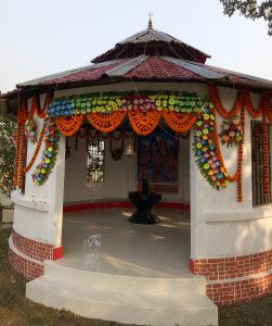
Details Kaliyaganj Town: Kaliaganj is a city and a municipality in Uttar Dinajpur district in the Indian state of West Bengal.You can easily get regular trains to Kaliyaganj from other major cities(Town) of the country.Kaliyaganj does not have an airport. Nearest airport is Bagdogra Airport.There are no bus routes from other major cities to Kaliyaganj. Nearest bus stand is Balurghat(Dakshin Dinagpur) and Raiganj(Uttar Dinajpur) [Read Also- Maa Boira kali Puja Pandel, Kaliyaganj Kali Puja]

Map of Uttar Dinajpur
 |
| Uttar Dinajpur Map |
Country:-India
State :-West Bengal
District :-Uttar Dinajpur
Elevation :-40 m (130 ft)
Population (2001) :-Total 47,639
Languages:-Official Bengali, English
PIN – 733129
Telephone code – 03523
Lok Sabha constituency:– Raiganj
Vidhan Sabha constituency :-Kaliaganj
How to reach Kaliyaganj town
By Bus
BY TRAIN
You can easily get regular trains to Kaliyaganj from other major cities of the country.
Railway Station(s): Kaliyaganj (KAJ)
BY FLIGHT
Kaliyaganj does not have an airport. Nearest airport is Bagdogra Airport.
Kaliyaganj
117 km away
Bagdogra Airport (IXB), Bagdogra, West Bengal
Kaliyaganj
338 km away
Map of Kaliyaganj Town
লিঙ্কটিতে ক্লিক করে পাঁচ সেকেন্ড অপেক্ষা করে SKIP AD ক্লিক করুন তবেই কাঙ্ক্ষিত সাইটে পৌঁছে যাবেন। কম্পিউটার সম্পর্কিত বাংলায় যাবতীয় টিপ ও নোট পেতে কম্পিউটার জগত সাইটে এখানে ক্লিক ভিজিট করুন।